11/18/2023
•
EN
Extracting information about spatial patterns from spatial signatures
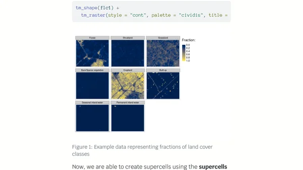
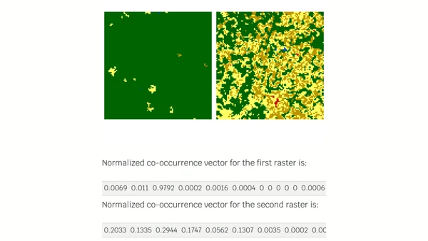
Explains how to extract and analyze spatial patterns from categorical raster data using the 'motif' R package and information theory metrics.