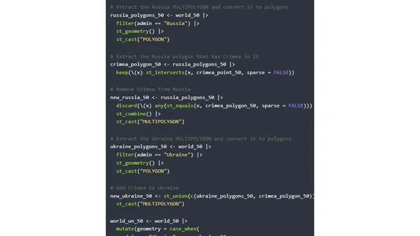
How to move Crimea from Russia to Ukraine in maps with R
A technical tutorial on using R and the sf package to adjust map boundaries, specifically addressing the Crimea region's political representation in geographic data.
Using R and geospatial data to calculate and compare the proportion of coastline to land borders for US states, with Rhode Island as a key example.
A tutorial on fixing overplotted points on maps by creating filled density gradients using R, ggplot2, and the sf package for geographic data.
A tutorial on creating maps of Tolkien's Middle Earth using R, the {sf} package, and {ggplot2} for GIS data visualization.
A tutorial on using R to reproduce and analyze map projection distortions, focusing on the Web Mercator projection with reproducible code.
A technical tutorial on creating US maps with R, including Alaska and Hawaii as properly scaled insets using the sf and tmap packages.