Intersecting spheres and GPS
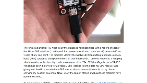
Explains how GPS uses intersecting spheres from satellite distances to determine location, including error corrections and linear algebra.
A technical guide on creating interactive web maps using Django's GeoDjango module, Pillow for image GPS data, and Leaflet for mapping.
A beginner's guide to setting up GPS tracking with the Notecard hardware module, covering hardware setup and initial configuration.
A tutorial on implementing geofences using Blues Notecard hardware and Datacake's new Zones feature for location-based notifications.
A guide on integrating an external GPS/GNSS module with the Notecard for continuous location streaming and cellular connectivity.
A developer builds a Raspberry Pi home dashboard with GPS, temperature, and printer modules, detailing the architecture and open-source code.
Analyzes the privacy and effectiveness issues of digital contact tracing, comparing location-based and proximity-based approaches.
Overview of Windows Phone 7 features for developers, including accelerometer, GPS, microphone, and more.
A guide to geotagging photos from non-GPS cameras using an iPhone's background GPS tracking and desktop software.