Awesome Isochrones
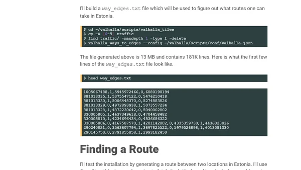
Read OriginalThis article provides a detailed, step-by-step guide to installing and configuring the Valhalla routing engine (a C++ project) on Ubuntu. It explains how to use Valhalla with OpenStreetMap geographic data to create isochrone maps, which visualize travel distances from a point within a set time. The tutorial covers building dependencies, downloading map data, and preparing for visualization with QGIS.
0 comments
Comments
No comments yet
Be the first to share your thoughts!
Browser Extension
Get instant access to AllDevBlogs from your browser
Top of the Week
1
Limit token usage in Microsoft Agent Framework
Jesse Liberty
•
1 votes
2
How to Roll Back AI Agents: Incident Response, Circuit Breakers, and Recovery Patterns
Paul Bryant
•
1 votes
3
Avoiding Reasoning Model Failures with Microsoft Foundry
Luke Murray
•
1 votes
4
When Your AI Agent Lies: Silent LLM Fallbacks
Luke Murray
•
1 votes
5
Adding a custom MCP server to Claude and ChatGPT
Simon Willison
•
1 votes
6
Testing AI prompts and comparing models with promptfoo
Tim Deschryver
•
1 votes
7
Superlogical
Mitchell Hashimoto
•
1 votes